

Emodnet – High Resolution Seabed Mapping
The European Maritime Observation and Data Network (EMODnet), an initiative of the European Commission's Directorate-General for Maritime Affairs and Fisheries (DG MARE), is composed of a partnership of more than one hundred of European organizations working together to gather marine data from a variety of sources, with the aim of making them more accessible and interoperable.
Part of the work involves linking to national, regional or thematic data repositories in which lies the basic information and the creation of outreach products. Thematic groups have been set up to organize the data available from various sources, assess their quality, ensure that they are accompanied by metadata and provide such data through thematic portals in the areas of bathymetry, geology, habitats, biology, chemistry, physical oceanography, and human activities.
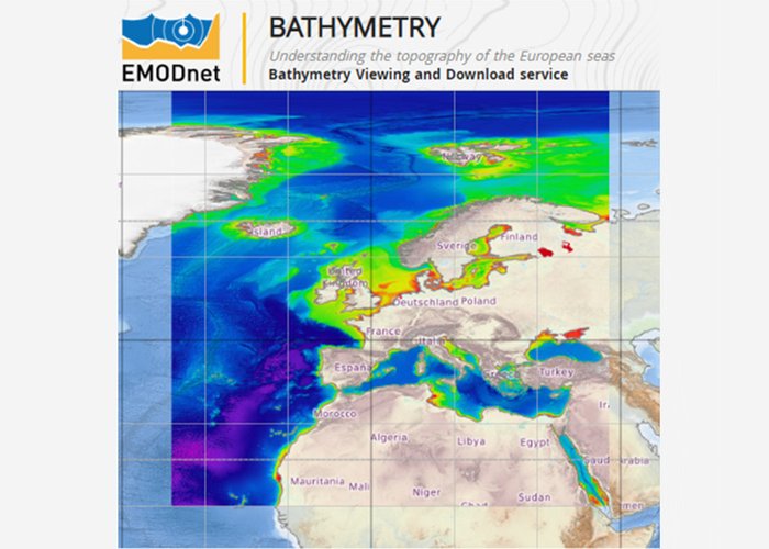
The High Resolution Seabed Mapping (HRSM) project aims to create and maintain an operational service that provides free and open access to the seabed and coastal sea basin bathymetric models at the best resolution possible.
For more information go to the EMODnet Central Portal:
http://www.emodnet.ec.europa.eu/
Comissão Europeia
The updated version of the Digital Terrain Model of the European Maritime Basins, corresponding to Phase III of this project, will be published in February 2023.
A new phase of the project (2022-2024) began in December 2022, which will continue to contribute to increasing knowledge of the marine environment, stimulating innovation in the blue economy and increasing the accessibility and interoperability of marine data.
EMODNET-HRSM-faseII
EMODNET-HRSM-faseII
2021-01-01 | 2024-12-31
85 %
Partners
14
2017-01-01