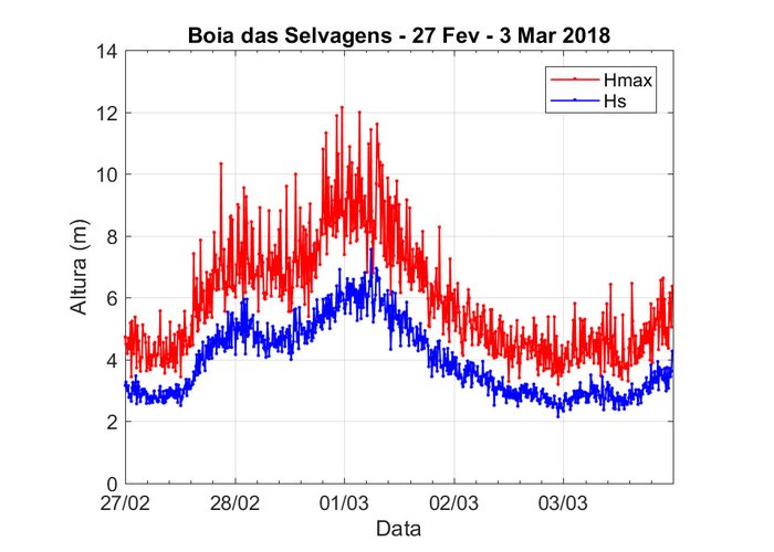
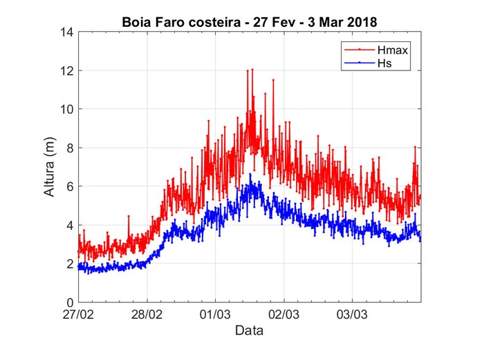
Logs of the buoys during the storm
In recent days there has been a worsening of the state of the sea on the Portuguese coast, with a special focus on the archipelago of Madeira and the southern coast of mainland Portugal.
In Madeira, the period of greatest intensity of the storm was between the end of February 28 and the first hours of March 1 and in Faro around 1:00 p.m. on March 1.
On the west coast the aggravation continues to be felt, although with more moderate intensity.
In the archipelago of Madeira it was registered in the wave-basin of Funchal, on the morning of the 28th of February, a maximum height of 11m and a significant height of 6m, with predominant direction of the west. On the night of 28 February, a maximum height of 12m and a significant height of 8m, with a west direction, were recorded in the Selvagens buoy.
In continental Portugal, there was an intensification of rippling from SW / W, reaching the southern coast more severely. It was registered on the morning of March 1st a maximum height of 12 m and a significant height of about 7 m.


