Hydrographic Institute Conducts Surveys in Strategic Areas for Portugal's Energy Transition and Economic Development
The Hydrographic Institute (HI) of the Portuguese Navy is currently engaged in several programs aimed at characterizing the marine environment and producing cartography based on high-resolution hydrographic surveys conducted off the coast of mainland Portugal.
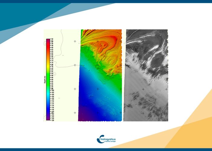
The images reproduced here, recently obtained off the coast of mainland Portugal, not only serve the specified purposes but also hold significant value for any planning, sizing, and installation project for structures in the coastal zone of the Portuguese margin. This is particularly relevant for projects anticipated for the offshore wind energy production.
The hydrographic surveys, conducted with a multibeam sonar, enable the creation of detailed bathymetric models of the seafloor relief (color image), as well as the corresponding acoustic mosaic (gray-scale image). Following selective sediment sampling, this information will be transformed into a remote classification map detailing the seafloor type and sedimentary deposits.
In response to identified needs for an adequate physical description of the sedimentary layer, the HI intends to further characterize the seafloor structures by conducting geophysical and geotechnical surveys. This will involve equipment such as seismic reflection devices, side-scan sonar, gradiometer, and the collection of vertical samples (corers) from the sediment column.


