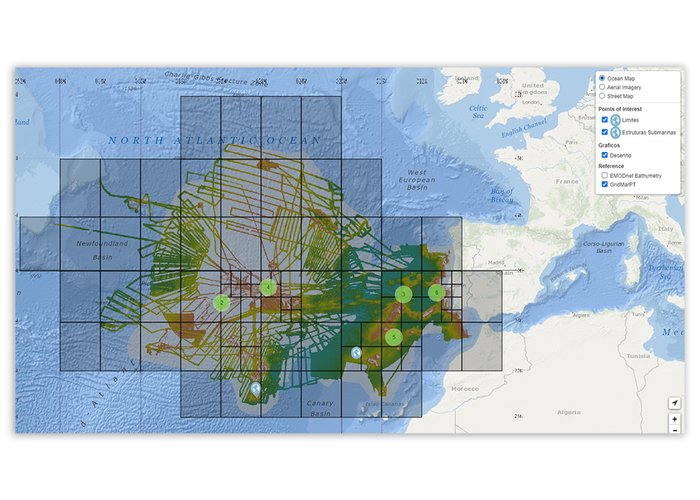
Hydrographic Institute provides data on seafloor relief
Based on the mission of the SEAMAP 2030 program (Mapping the Portuguese Sea), the Hydrographic Institute (IH), in partnership with the Mission Structure for the Extension of the Continental Shelf, began to provide data grids on the relief of the seabed, in areas where the IH has bathymetric data, in order to contribute to the conservation and sustainable use of the sea, supporting research and promoting development.
These grids, with resolution as a function of depth, are a significant contribution to the knowledge of the ocean, supporting the SEABED 2030 project and, consequently, the objectives of the United Nations Decade of Ocean Science for sustainable development.
The conservation and sustainable use of the oceans implies their understanding, and it is necessary to ensure multidisciplinary knowledge, based on the information of the morphology of the seabed.
Resolutions available:
- Depth 50m-250m - Res. 32m
- Depth 250m-1000m - Res. 64m
- Depth 1000m-2000m - Res. 128m
- Depth 2000m-4000m - 256m resolution
- Depth +4000m - Res. 512m
The data can be accessed at: https://gridmar.Hidrografico.pt.


