AANChOR (All Atlantic Research Alliance)
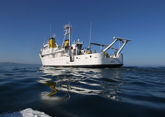
A team of 11 researchers and students from Instituto Hidrográfico (IH, Portugal), Instituto de Engenharias e Ciências do Mar – Universidade Técnica do Atlântico Technical (ISECMAR UTA, Cape Verde) and Helmholtz Centre for Ocean Research Kiel (GEOMAR, Germany) started on the 30 October a program of multidisciplinary observations on the waters of the Archipelago de Cabo Verde. The program of observations will be conducted until 15 November onboard NRP D. Carlos I, a hydrographic vessel from the Portuguese Navy, and is integrated in the broader cooperation mission “Iniciativa Mar Aberto” (“Open Sea Initiative”). The work will be developed in a close collaboration with the Institute for the Sea (IMAR) from Cape Verde.
On the scientific perspective this research cruise aims to collect a comprehensive set of physical, biogeochemical, and biological data in the global area of the Cape Verde Archipelago that could contribute to better understand how the large-scale circulation in this area forces the complex dynamics around and between the islands of the archipelago. A particular focus will be given to characterize the influences from the African continent over the study area (promoted for example by large upwelling filaments) and the processes affecting areas marked by extreme topography such as the Joao Valente Submarine Bank (a still largely unknown area) and the Senghor Seamount.
During the 15 days of mission at sea NRP D. Carlos I will pass offshore each one of the ten islands of Cape Verde conducting measurements of physical, chemical, and biological variables in the water column from surface to depths of 1500 m. Multiparametric probes equipped with water sampling systems will be used to profile the water properties at specific locations and collect samples at selected depths. Ongoing systems, such as acoustic Doppler current profilers or flow-through systems will be used to continuously monitor several parameters along the ship tracks. Satellite imagery will be used to identify the surface signatures of mesoscale features and to decide the position for the launching of an autonomous vehicle (waveglider) from GEOMAR. This vehicle will remain at sea for the following months, contributing to the monitoring of the surface waters offshore Cape Verde. A Spotter wave buoy will be deployed by Instituto Hidrográfico in the southern coast of Sao Vicente island and operated jointly by this institute and IMAR, providing real time measurements of the wave conditions affecting that coast.
The work program to be conducted in Cape Verde is the more visible expression of the cooperative actions for observation in the Atlantic areas that are include in the mission Mar Aberto and that will extend to the global oceanic domain from Portugal to Cape Verde and from there to Angola and latter to Sao Tome and Principe. All along the ship track surface drifters will be released as part of the collaboration of Instituto Hidrográfico with E-SURFMAR and the Surface Drifter Program from NOAA (United States). A program of identification of areas of high concentration of sargassum and collection of samples for latter lab analysis will be conducted along the tracks as part of a collaboration between Instituto Hidrográfico and from Lamont Doherty Earth Observatory at Columbia University (United States).
The broad collaborative actions to be developed during this mission form the core of a case study for cooperative observation in the Atlantic which will be developed in the framework of the All-Atlantic Marine Research Infrastructure Network (AA-MARINET) Joint Action supported by the All-Atlantic Ocean Research Alliance (AANChOR-CSA) European project.


